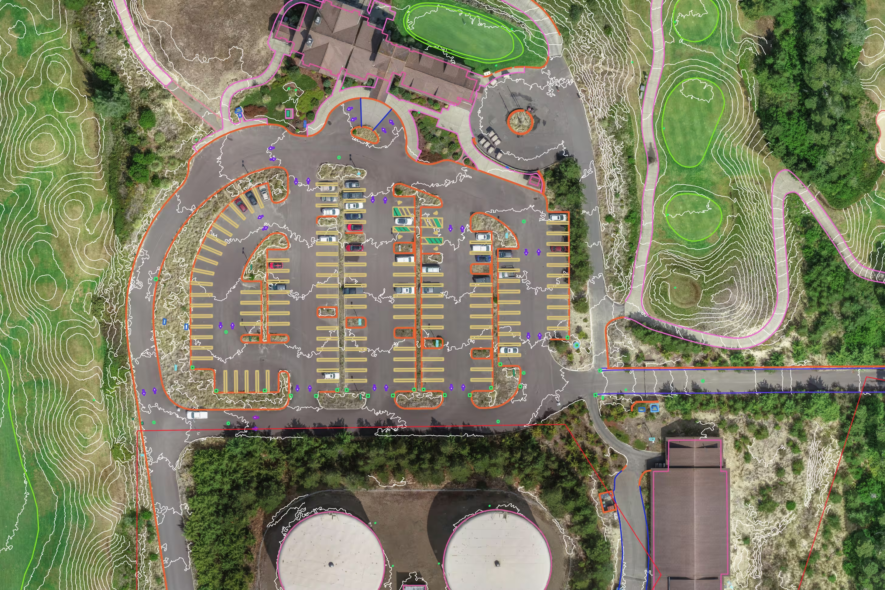
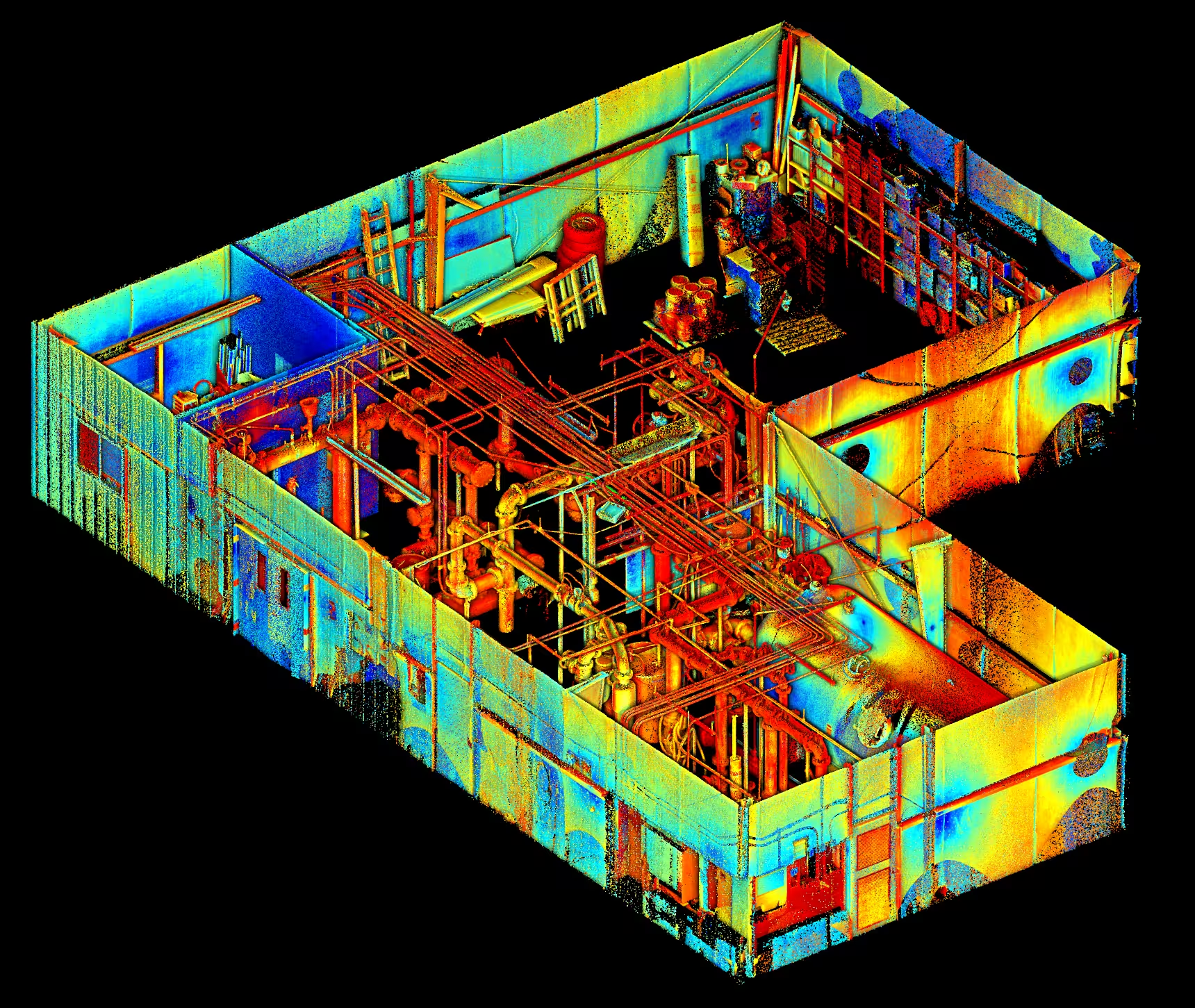
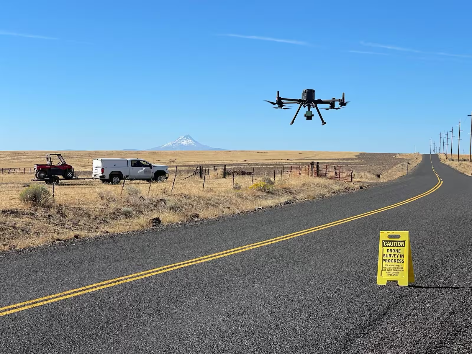
Advanced Drone (UAS) Surveying for High-Resolution Mapping Aerial data collection has never been more precise. Our advanced drone (UAS) surveying services provide high-resolution mapping for land development, construction, and infrastructure projects. With state-of-the-art sensors and photogrammetry, we capture detailed site data quickly and efficiently, giving engineers and developers the insights they need to make informed decisions. Terrestrial Scanning & LiDAR for Detailed Site Analysis For projects requiring extreme accuracy, our terrestrial scanning and LiDAR services deliver unmatched detail. Using high-density laser scanning, we create precise 3D models of terrain, structures, and infrastructure, making it easier to analyze land features, detect elevation changes, and streamline design workflows. Whether for topographic mapping, utility planning, or structural assessments, we provide the data that keeps projects moving forward. Revolutionizing Surveying with UAV & Remote Sensing Technology Traditional surveying methods are evolving, and remote sensing is leading the way. Our UAV and remote sensing solutions enhance project efficiency by capturing large-scale, high-precision data with minimal disruption to worksites. From construction monitoring to environmental studies, our technology-driven approach ensures accurate results while reducing time and labor costs. Faster, Safer, & More Accurate Surveys with Drone & Remote Sensing Tech Surveying complex or hazardous environments is no longer a challenge with drone and remote sensing technology. Our UAV surveys provide rapid data collection with improved safety, eliminating the need for surveyors to navigate dangerous terrain. With advanced imaging, LiDAR, and photogrammetry, we deliver the accuracy needed to support construction, land development, and infrastructure projects with confidence Why Choose S&F for UAS & Remote Sensing Surveys? Innovation and accuracy drive everything we do. At S&F, we don’t just collect data—we deliver actionable insights with cutting-edge drone and remote sensing technology. Our expertise in aerial mapping, LiDAR scanning, and photogrammetry ensures you get the precision you need while saving time and reducing costs. Whether mapping vast construction sites or monitoring infrastructure, we bring efficiency, safety, and reliability to every project. Contact us today for more information.